Streets Q-T
Read about Blackpool’s History >>> here <<<
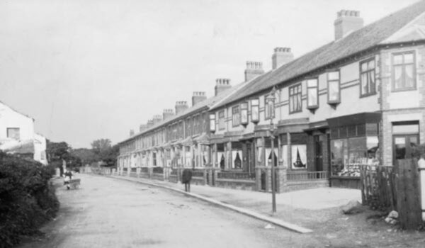
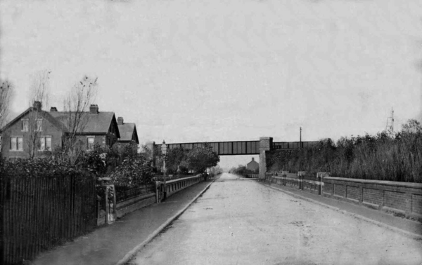
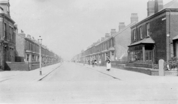
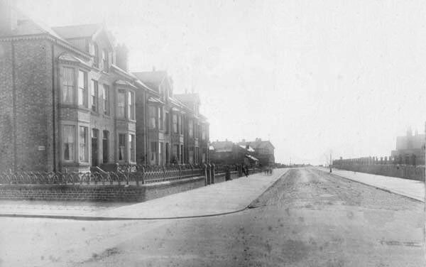
Queen Victoria Road – 1914
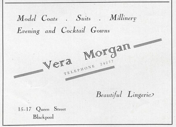
15-17 Queen Street – 1952
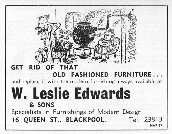
16 Queen Street – 1969
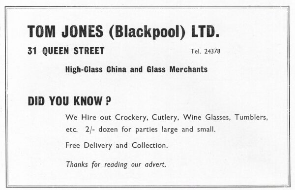
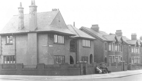
31 Queen Street – 1965
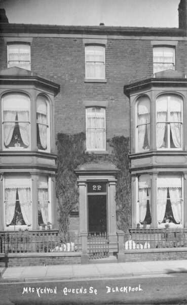
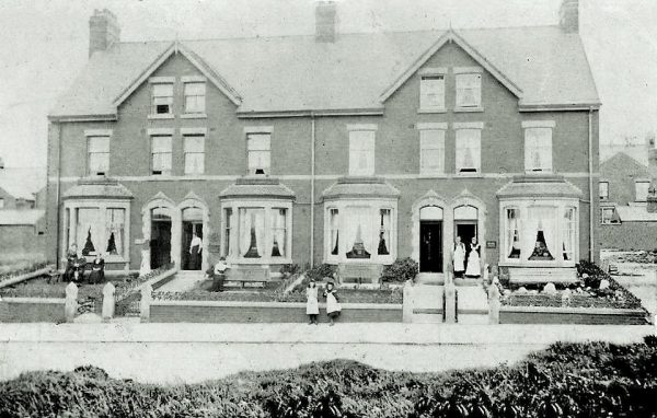
22 Queen Street, apartments run by Mrs Kenyon
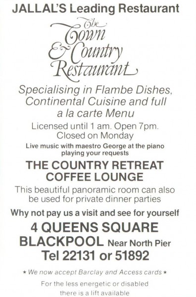
Queens Square – Jallal’s – 1982
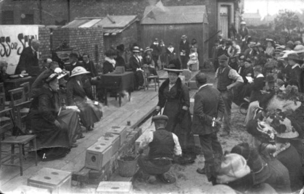
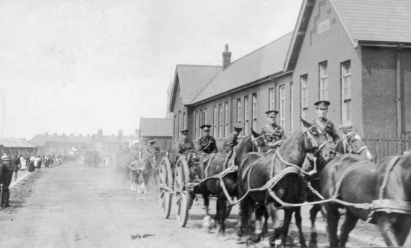
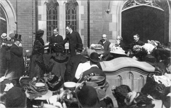
The stone laying of the Sunday School at Raikes Parade Methodist Church on 17th September 1913
Mrs. Wells laid the stone on behalf of “the ladies of the congregation”
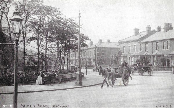
Raikes Parade Church
Raikes Road, later renamed Church Street
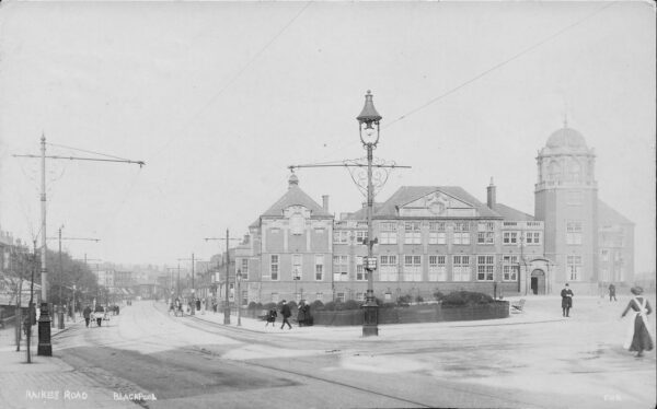
Raikes Parade – 1965
Raikes Parade – 1950
Raikes Road, from Devonshire Square, looking at Oxford Road.
The horse and cart is heading onto what is now Whitegate Drive. The buildings on the right were later converted into shops, then John Thompson Ltd. The block has now been demolished, replaced with new apartments
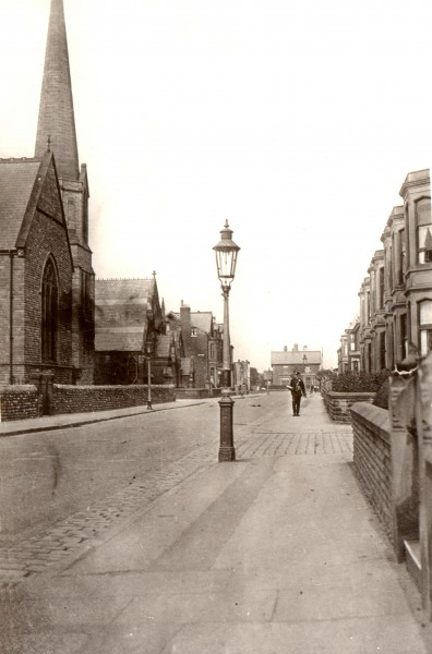
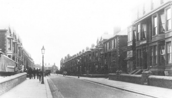
Rawcliffe Street from Church Street (now Bond Street)
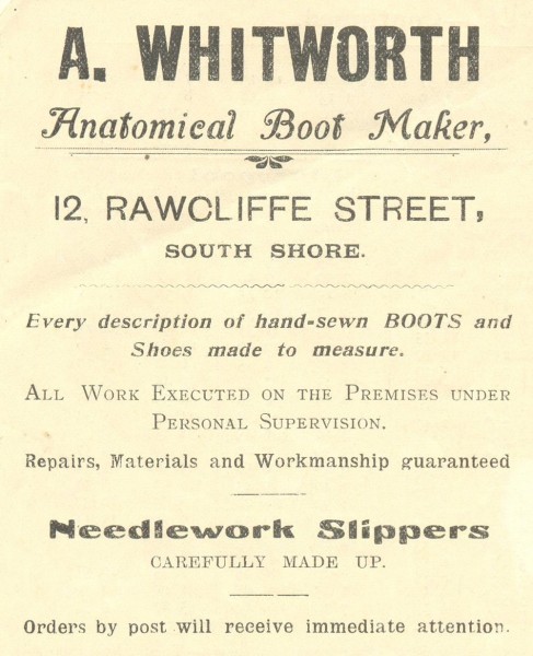
A. Whitworth – Anatomical Boot Maker – 1907
12 Rawcliffe Street
Railway View
Previously called West View Avenue – renamed on 1st February 1929
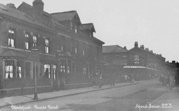
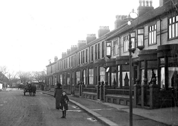
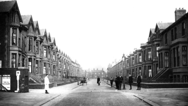
Reads Road – 1914
Reads Avenue
Previously called Reads Road – renamed on 1st February 1929
Reads Road from Central Drive looking at Coronation Street.
Reads Road continued to Park Road, from where it became Reads Avenue as it is today
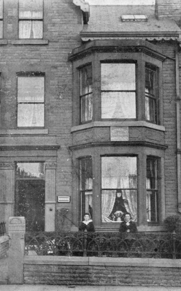
10 Read’s Road, Horridge Apartments – 1908
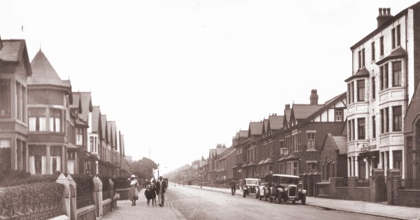
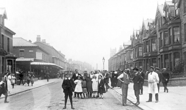
Reads Avenue from Livingstone Road
The small church on the right is now a car park
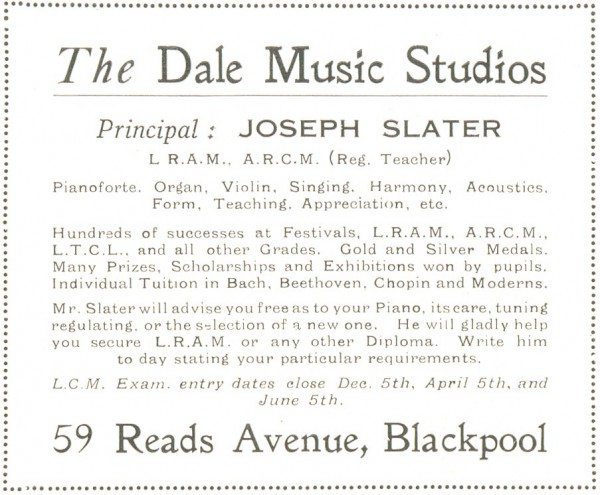
Dale Music Studios – Joseph Slater – 1930
59 Reads Avenue
Red Bank Road – Bispham – 1918
Shows the view towards Bispham village along a much narrower and quieter road. On the left, Aspen’s or Uptown Farm hides Bamber’s Farm from view. The trees in the distance surrounded the Bethel Chapel and school. The houses on the right still survive today, the terrace known as Westgate
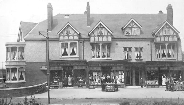
Red Bank Road showing a block of shops, corner of Beaufort Avenue
House on the corner formerly ‘Wave crest’ now ‘Beaufort Lodge’. Shops left to right are T.Murgatroyd, the bootmaker, E & A Dawson, drapers and Red Bank Road Post Office and cafe, subpostmaster J. Carter, who opened his first business in Bispham during 1896 as a confectioner’s and tobacconist. His brother opened Bispham’s first chemist shop. Reading the newspaper flysheet, terrorism in Belfast was making the headlines, even in c.1912.
A block of 4 houses on the south side of Red Bank Road. Now converted into shops and cafes. Dated to about 1907. Later on the two houses on the right had the lower bayed extended upwards and became Sea View Apartments !
Even in this view the upper bays have not been added to the two houses on the end right, but two more houses have been built on the left. Further down the road to the left became the site for Sainsbury’s
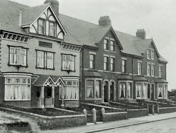
Westgate, part of Red Bank Road. The terrace on the right is was called ‘Westgate’, but some say that it could be the old name for the road from the village !
Regent Road
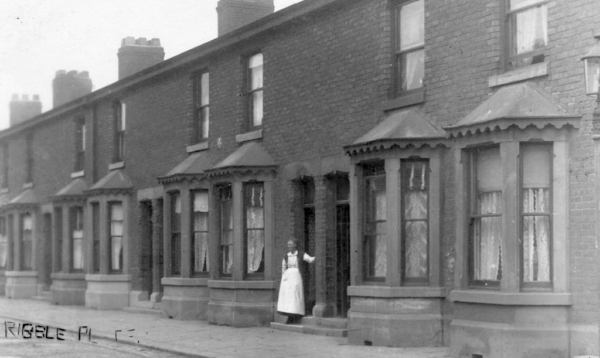
Ribble Place
Now renamed Sutton Place on 1st February 1929
Saint Albans Road, off Whitegate Drive
Saint Annes Road when is was called Middle Lane
The distinctive railway bridge at Watson Road is now part of Yeadon Way
Saint Annes Road junction with Highfield Road. A view much the same today
Saint Chads Road, from the promenade, from the Garth Series
Saint Chads Road, from the promenade
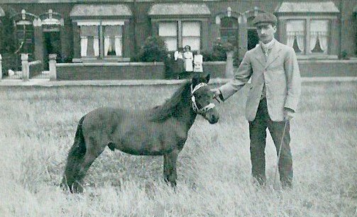
“Tiny Dot”, Smallest horse in the world. Was she at the Tower Circus ?
The location has been identified as Saint James Road, South Shore – 1907
The houses in the background look the same today
Saint Heliers Road, from Waterloo Road
Saint Heliers Road, from Bloomfield Road
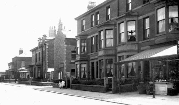
Saint Paul’s Road looking towards Sherbourne Road
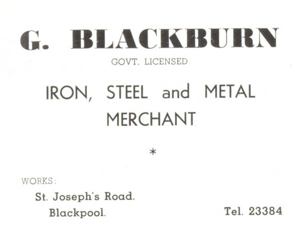
Saint Joseph’s Road – G. Blackburn – Iron, steele and metal merchant – 1953
Sandhurst Avenue
Previously called Victoria Road – renamed on 1st February 1929
Scarsdale Avenue
Previously called Highfield Avenue – renamed on 1st February 1929
Sedbergh Avenue
Previously called Oxford Avenue – renamed on 1st February 1929
Shaftesbury Avenue
Shannon Street
Previously called West Caroline Street – renamed on 1st February 1929
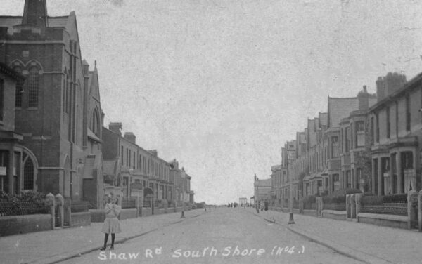
Shaw Road, from the Lytham Road end
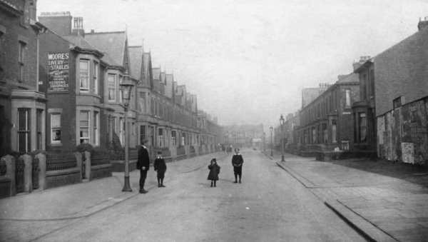
Shaw Road, from Bolton Street. The vacant plot on the right is now Lowes Court
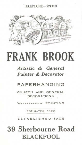
Frank Brook – Painter & Decorator – 1930
39 Sherbourne Road
Springfield Road
Springfield Road, corner of Lord Street.
This view had long since gone. Demolished when the Odeon was built on Dickson Road. This is the rear of what is now Funny Girls
Springfield Road, junction with Dickson Road
Seen here in 1937 before the site was cleared for the Odeon Cinema
 Squires Gate – 1967
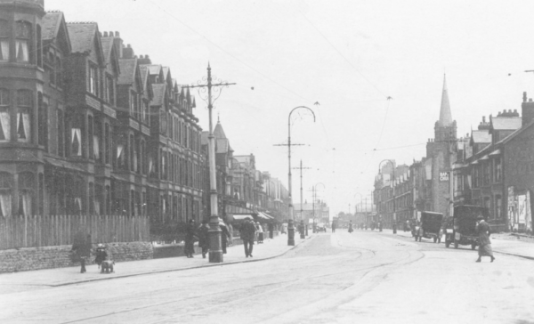
Station Road looking west towards the sea from Church Street (Bond Street)
The vicarage can be seen on the right
Kaemar – 40 Station Road – 1966
Station Road, showing a tram passing the empty plot on the right
Station Road – 1957
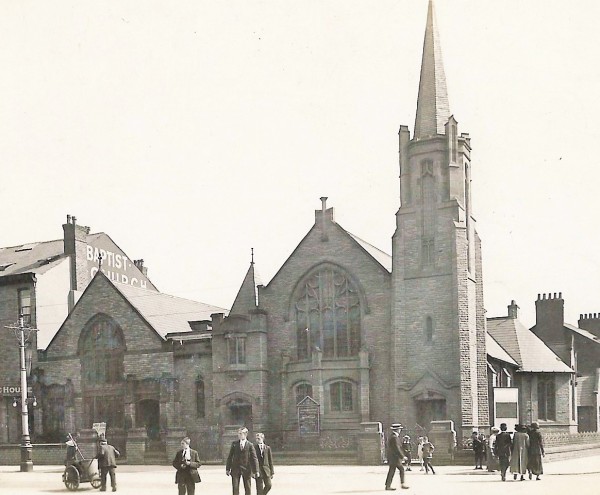
Station Road & Bond Street – Baptist Church
Station Road – 1907
Station Road showing the Baptist Church on right
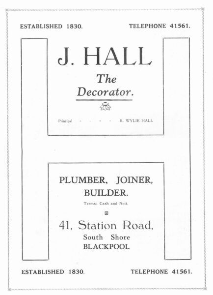
J. Hall – 41 Station Road – 1957
Sutton Place
Previously Ribble Place, renamed on 1st February 1929
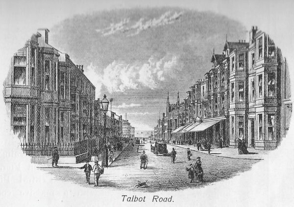
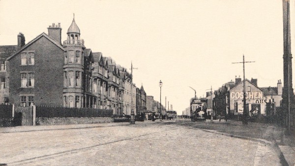
Talbot Road – 1860’s
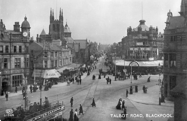
Talbot Road looking towards Talbot Square
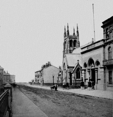
Shows the Sacred Heart Church and the presbytery next door
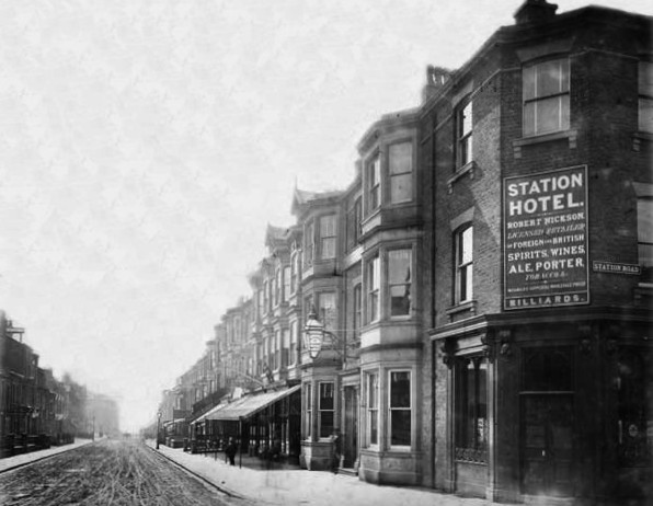
Talbot Road – Station Hotel
Talbot Road looking down towards the sea
The parade of shops of the right now includes Home Bargains (ex Woolworth’s), Taboo bar, Shoe Market, and various charity shops
Talbot Road
 Talbot Road – 1967 – W.L. Cookson Ltd
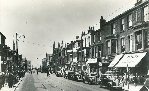
Talbot Road – 1967
 Talbot Road – 1967
 Temple Street – 1967
 5 The Strand
 20 The Strand
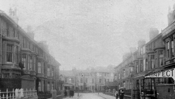
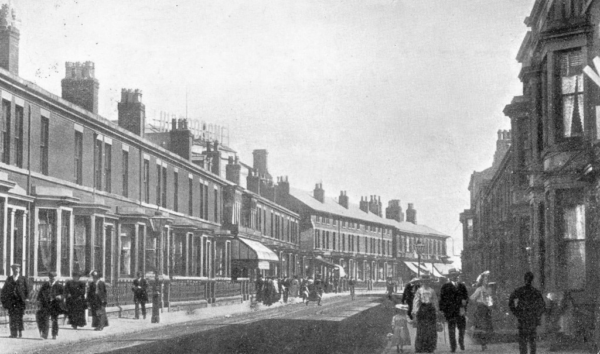 Topping Street looking towards Church Street.
The Hippodrome sign can just be seen above the houses on the left
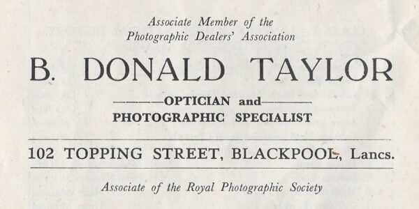
102 Topping Street – 1948
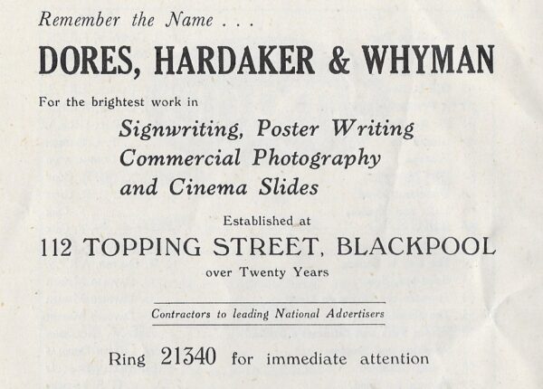
112 Topping Street – 1948
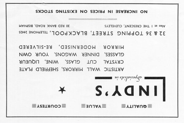
Lindy’s – 32 & 36 Topping Street – 1956
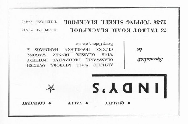
Lindy’s – 32-36 Topping Street & 78 Talbot Road – 1965
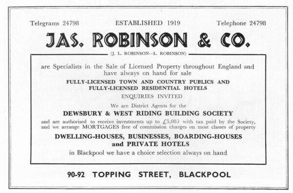
90-92 Topping Street – 1958
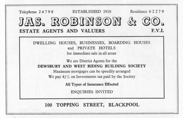
100 Topping Street – 1967
Trafalgar Road, from the promenade
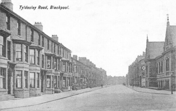
Tyldesley Road looking south – c.1914
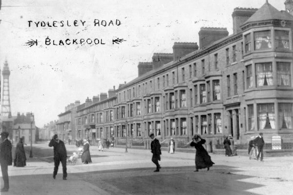
Tyldesley Road looking north – c.1914
Tyne Avenue
Previously called Alexandra Avenue – renamed on 1st February 1929